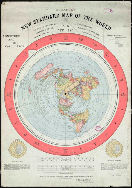
Azimuthal Equidistant Projection
This projection displays all points at proportionately correct distances from the center point. Points that are not along a single point of longitude become more distorted the farther they are from the center point. This type of projection is useful for airplane paths and radio transmitters.
Gleason's 1892 World Map
The map that seems to be referred to as the most accurate is the Gleason's New Standard Map of the World. At first glance it is very detailed with latitude, longitude, and time zones. The center point of the map is the North Pole and Antarctica surrounds the outside.
You can download the full resolution map by clicking the link: Download
The next step is to analyze the scale of the map. The maps scale displays English miles corresponding to nautical miles. Nautical miles referring to miles over seas. My first question was why it was not a constant scale if it was a true representation of Earth. But I'm not entirely sure so let's check out the math on the projection.
I created a calculator and explain the math on my next post here.


Nice! thank you so much! Thank you for sharing. Your blog posts are more interesting and informative.
ReplyDeleteflat earthers